Torremendo
Interesting Torremendo map and guide to the village.
Satellite Map of Torremendo Costa Blanca Spain
Torremendo Map: Above you can view an interesting Google satellite map of Torremendo, a small village inland from the Costa Blanca coastline. Also shown is the huge Embalse de Pedrera reservoir, which Torremendo overlooks.
Torremendo is a peaceful little Spanish village, surrounded by orange and lemon groves, the inhabitants are mostly Spanish though a number of Brits and other nationalities have chosen to make the village their home.
 Torremendo is around 4 kilometres from the town of San Miguel de Salinas and 16 kilometres from Orihuela, the beaches of the Orihuela Costa are just a short drive away, giving thoise living there the opportunity of countryside living while still having easy access to the sea and beaches.
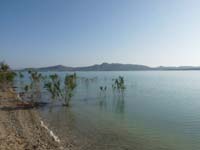
Torremendo overlooks the large freshwater lake, the Embalse de Pedrera, a popular area for nature lovers and fishermen, who enjoy the free fishing which is to be had there. There are a good number of carp in the lake, there are also black bass.
The village itself has a decent range of facilities with cafes, bars and restaurants and basic shops.
Torremendo can be reached from the CV-95 between San Miguel de Salinas and Bigastro, taking the turning for Lo Rufete and Torremendo.
Nearby Places: San Miguel de Salinas - Torrevieja - Cabo Roig - Pilar de la Horadada - Bigastro - Hurchillo - Benejuzar - Algorfa
Golf Courses: Villamartin - Las Ramblas - Campoamor - La Finca - Lo Romero - Spain Golf Courses
Related: Orihuela Costa - Alicante - Murcia - Orihuela - Ciudad Quesada - Mar Menor - Cartagena - Builders
HOME
