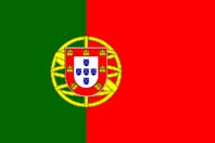
Portugal Map
Detailed Road Map of Portugal
Portugal Map - Detailed Road Map of Portugal - Zoomable road map of Portugal a European country to the west of Spain. Portugal is a popular holiday destination especially the region called the Algarve, the capital city of the country is Lisbon.
Using the buttons on the top left you can 'zoom' and 'pan' to get a detailed street map of Portugal and plan your visit to the country. It is also possible to view the cities, towns, and resorts of Lisbon, Porto, Coimbra, Faro, Sintra, Cascals, Setubal, Albufeira, Loulé, Alvor, Lagos, Leiria, Tavira and Portimao.
The most westerly country of mainland Europe, Portugal (officially the Portuguese Republic) is bordered by Spain to the north and east and the Atlantic Ocean to the west and south, it has a population of approximately 10.6 million and an area of 35,645 square miles. Settled since early times it was incorporated into the Roman Empire in the 2nd century BC and after the collapse of the Roman Empire was ruled by the Visigoths until the arrival of the Moors in the 8th Century, it became an independent country in the early 12th century and was virtually free of Muslim control by 1249.
During the 15th and 16th centuries its powerful navy enabled it to establish a large empire with possessions in Africa, and South America (in particular Brazil). These days a popular holiday destination, its Algarve coastline being especially attractive to holidaymakers seeking sun, sea and sand.
Portugal Links: Portugal Factfile - Portugal Weather
Algarve Links: Algarve Guide - Algarve Map - Algarve Weather - Faro Airport Transfers
Algarve Places: Albufeira - Portimao - Alvor - Tavira - Vilamoura - Faro - Praia da Rocha - Lagos - Carvoeiro - Sagres - Praia da Luz - Silves - Luz
Algarve Hotels: Aparthotel Albufeira - Vilamoura - Tivoli Marinotel
Portugal Places: Coimbra - Leiria - Lisbon
Portugal Rentals: Property
More Info: Algarve Weather Forecast
Related: The Douro River - The Algarve - Travel Articles - Other Places - Builders
HOME
