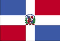
Dominican Republic Map
Detailed Road Map of Dominican Republic
Dominican Republic Map - Zoomable road map of Dominican Republic, a country on the island of Hispaniola in the Caribbean Sea.
Using the buttons on the top left you can 'zoom' and 'pan' to get a detailed road map of the Dominican Republic and plan your visit to the country. It is also possible to view the cities of Santiago, Santo Domingo, Cabo Rojo, Juan Dolio, La Romana, Azua, Cabarete, Canoa, and Bavaro.
The Dominican Republic occupies about two thirds of the island of Hispaniola in the Caribbean Sea, the other third being occupied by Haiti. The Dominican Republic has a population of around 10 million and an area of 48,442 square kilometres, it is a popular holiday destination specializing in all-inclusive style holidays.
Dominican Republic Links: Dominican Republic Weather
Related Links: Bahamas Map - Bahamas Weather - Bermuda Map - Bermuda Weather - Panama Map - Panama Weather - Cabo San Lucas Map - Buenos Aires - Buenos Aires Map - Buenos Aires Weather
Related: Travel Articles - Other Places - Builders
HOME
