Costa Blanca Map
Costa Blanca Maps - Map of the Southern Costa Blanca
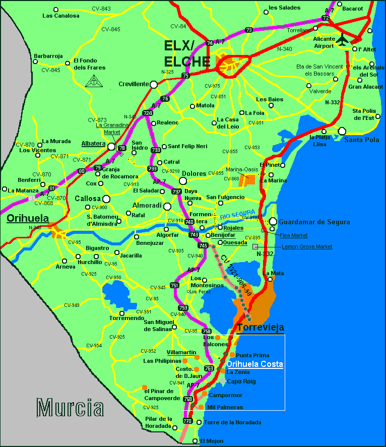
Costa Blanca map - Regional map of the Costa Blanca South including Alicante, El Altet, Santa Pola, Guardamar, Rojales, Benjofar, Quesada, Almoradi, Bigastro, Algorfa, La Mata, Torrevieja, La Zenia, Cabo Roig, Campoamor, Pilar, Villamartin and El Mojon. The very popular stretch of the southern area is known as the Orihuela Costa and has some fine 'blue flag' beaches and some excellent facilities. For airport transfers to the area click here:- Alicante and Murcia Airport Transfers and for details of property for sale and rent in the area look here:- Costa Blanca Property
© Needahand Spanish Properties 2006-2007 - Costa Blanca Map