

Cabo Roig Street Map

Cabo Roig Street Map
Cabo Roig Street Map

Cabo Roig Street Map
Links to Other Pages
Home - Costa Blanca Property
Apartments
Houses
Villas
Bungalow
Airport Transfers
Costa Blanca Rentals
Contact
More Maps
Orihuela Costa
Costa Blanca
Aguamarina
La Regia
Playa Flamenca
Links to Other Pages
Home - Costa Blanca Property
Apartments
Houses
Villas
Bungalow
Airport Transfers
Costa Blanca Rentals
Contact
More Maps
Orihuela Costa
Costa Blanca
Aguamarina
La Regia
Playa Flamenca

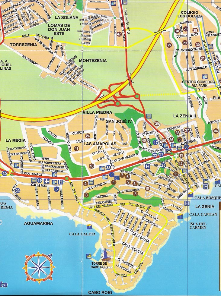
Above is a detailed Cabo Roig street map showing beaches and hotels. Also the areas of Aguamarina, La Regia and La Zenia - also shown is the La Zenia Hotel. The main roads shown are the N-332 coastal road and the AP-7 motorway which can be used to acess Cabo Roig from either the Dehesa de Campoamor exit of the La Zenia exit. The other Orihuela Costa resorts of Playa Flamenca, Mil Palmeras and Punta Prima are just a short drive away.
Cabo Roig Rentals - Cabo Roig Beach - Cabo Roig Weather - Cabo Roig Property
Cabo Roig Rentals - Cabo Roig Beach - Cabo Roig Weather - Cabo Roig Property
© Needahand Spanish Properties 2006 - Cabo Roig Street Map